Whether you’re starting from the South Sound or the North Sound you will eventually connect to the beginning leg of A ‘Park Like’ Setting
Leg 1: To Hope Island State ParkOur point of origin for ‘A Park Like Setting’ is near the Whidbey Island side of the Mukilteo Ferry Route (+47° 58′ 30.77″N, -122° 20′ 32.56″W ). As you head north on the inside of Whidbey you’ll navigate (Chart 18423A) up Saratoga Passage cruising past the Port of South Whidbey at Langley, the entrance to Holmes Harbor and Cama Beach State Park. With Camano Island to the east, you’ll hug Camano’s shoreline all the way to Rocky Point on the north end on the island. You’ll now head toward Strawberry Point and round it up to the NE keeping the red buoys to your starboard side to maintain a proper distance from the shallow area. As you pass the entrance to the Swinomish Channel, Hope Island is 2 nautical miles directly in front of you. Leg 2: Hope Island to Jones Island (25Nm)You’ll need to check the tides in Deception Pass to select your time of departure. For detailed navigation through Deception Pass, consult your charts and be aware at all times to the ever changing whirlpools and currents. With Orcas Island’s Steep Point on your starboard side, follow the shoreline around as you move north up Spring Passage (between Jones Island and Orcas). Leg 3: Jones Island to Sucia Island (12nm)When you finally decide to leave Jones Island, likely due to the 3-night limit, the run up to Sucia is fairly short. A side trip that might be worth taking, head up and around Waldron Island to see if you can spot some Black Fish, porpoises maybe even some orca whales. From here you can create your own adventure, continue north up into British Columbia’s Gulf Islands, West toward Vancouver Island and Victoria or East into Bellingham Bay. We’ll be posting more cruise segments like this one, over time you’ll be about to connect a few together as you wish! Resources: Get an Annual Moorage Permit from Washington State Parks, for this trip it is well worth it. Send us your comments and suggestions for other segments… |
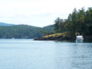
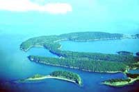
Hope Island State Park Courtesy: Washington State Parks Jones Island State ParkView Jones Island in a larger map  ___________________________________
 Sucia Island State ParkView Sucia Island in a larger map |
Cruising Northwest
A Northwest Cruising Guide, Boating Resource Guide and Magazine
Here to discover, expose, share and celebrate everything that is Cruising in the Northwest...
Cruising Northwest © 2016

