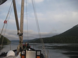
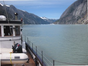
Cruising in the Inside Passage should be on every boater’s Must-Do List. The rewards for making the trip to Alaska are interesting towns and villages to visit, amazing natural beauty and a wild and remote feel you can’t find elsewhere. The southern part of the Inside Passage from Seattle to Desolation Sound is chic with upscale island towns full of art galleries, small wineries and craft breweries. North of Desolation Sound the Inside Passage grows more remote and wild. It’s where you’re most likely to find solitude. All of it is over-the-top beautiful.
For the last several weeks I’ve covered many topics about cruising in the Inside Passage from electronics, to charts, to planning your trip. This week, I’m going to focus on the natural aspects of the trip, and how wind, tides and geography affect your voyage, as well as how to take some of the apprehension out of cruising in the Inside Passage.
The Inside Passage gets its dramatic geography from advances of the massive Cordilleran ice sheet that pushed its way south, all the way to Washington State in the late Pleistocene. Evidence of this long ago glaciation is written into the Steep-walled fjords where grooves in the rocks show the slow-motion scraping rock and ice. When you begin to study the charts of the Inside Passage you’ll notice that the long winding deep inlets that cut into mainland are the beds of the long ago glaciers and you can trace their retreat to the high coastal mountains where their remnants still remain.
Currents:
The Inside Passage is famous for its fast currents. This is in part because water flooding and ebbing from the Pacific Ocean is constricted as it forces its way through the narrow passages.
I like cruising in the Inside Passage because so much of our day is dependent on currents — how strong they are, which way they are flowing, and how they interact with the wind and the tide all determine how long it will take us to get from one place to the next. To me currents are one way that Mother Nature way of lets us know that she is still in charge.
To plan our day we look at the current tables. It’s good to know what the current is doing for the area you plan to cruise, but it’s vitally important on a day that you plan to transit one of the tidal rapids.
There are numerous different current books and it is also available electronically. NOAA publishes the official set of current tables in a format that is rather dry, but filled with all the important information including the direction of the flood and the ebb for a specific area, the times of slack water, flood and ebb and the current speeds for each day. It is laid out with main “reference stations” and secondary stations and you need to do some math t
o find the times and velocities for a secondary station, but it’s all explained in the tables.
Tip: The information in the NOAA publication is ALL in Standard Time, so you have to remember to adjust for Daylight Savings Time.
The information for Washington and British Columbia is also published in Ports and Passes each year. This guide has a separate page for each station, and it’s in local time (including Pacific Daylight Time) so you don’t have to make any conversions. You just look up the place you want and the day, and it’s right there.
Tip: You’ll want the NOAA guide too, even if you have the Ports and Passes because it only goes to Prince Rupert, and you’ll need the NOAA version in Alaska. Also, don’t forget the tip above when you switch books.
Tides:
Tip: A couple of things to keep in mind with tide guides, is that not all prediction tables are corrected for daylight-saving time, and that the predictions are just that — predictions. The height and depth of the tide does not include variations caused by weather systems, such as strong low pressure system.
On the David B we use both electronic and paper tide books. There are many electronic tide prediction programs and apps, and you should be able to find one that suits you with a quick Google search. We use one called Mr. Tides.
Tidal Rapids:
When I first learned that going to Alaska in the Inside Passage meant going through tidal rapids, my heart skipped a beat. That sounded scary. I imaged white water rapids with the David B plunging through a mogul-like river course. Fortunately, that’s not what going through tidal rapids should be like if you plan properly and arrive at slack water.
Tidal rapids happen in narrow areas where there’s a restriction and lots of water needs to get through in a hurry. When a rapid is flowing at maximum flood or ebb, there can be overfalls of several feet and strong whirlpools that can swamp a small boat. I have always felt like a tidal rapid is a gateway that opens a closes at certain times of day. To pass you just need to know what time of day they are open, or in other words, when slack water occurs. If you arrive at the right time, you might feel a little push and pull from eddies, but the overall experience should feel controlled.
You can find the times for slack water for all the major tidal rapids in the Inside Passage by looking up the times in your current tables. There are some, such as Fords Terror in Alaska, where you’ll need local knowledge to know what time to arrive, but tidal rapids such as Seymour, Okisolo, Yuculta, Dent, Greene Point, Whirlpool and Skoocumchuck are all listed.
Weather:
For the most part the weather in the Inside Passage is benign in the spring and summer months. There is always the chance for a storm, but if you pay attention to the weather, you can always plan to remain tucked into some nice calm cove somewhere and wait out the weather. When you plan your cruise you’ll want to watch several places carefully: the Strait of Georgia, Johnstone Strait, Queen Charlotte Sound and Dixon Entrance. If you continue into Alaska past Ketchikan, you’ll want to pay attention to Clarence and Chatham Straits as well.
Seas in the Strait of Georgia and Johnstone Strait are primarily wind and current driven and can be nasty. Queen Charlotte Sound, Dixon Entrance, and Clarence Strait are affected by ocean swells and when combined with wind waves can make for a very uncomfortable and possibly dangerous day. For these reasons we pay attention to the weather systems that are approaching the coast and plan our crossing accordingly.
Over the years we have learned a few tricks. For Johnstone Strait and Queen Charlotte Sound, we usually leave early in the morning before the breezes have built up. We also have places scouted out ahead of time that we know we could duck into if we think there’s a chance that the weather will get too rough and we’d be happier waiting for calmer seas.
Cruising to Alaska in your own boat or on a tour like our Learn to Cruise trip is highly satisfying. If you take the time to learn the lay of the land and how the tides and currents play off one-another and you keep a careful watch on the weather you’ll be rewarded with the memories of a trip of a lifetime. The Inside Passage’s natural features make it special and its breathtaking scenery will amaze you. You will be forever changed by it.


What is your advice on people who just starting out on drive a boat in the ocean. Who want to the Alaskan trip.
Hi there,
That is a wide ranging question. We would be happy to direct you to and help you find as many resources as possible for your topic and question.
Thank you!
I’m planning a voyage from Ketchikan to Vancouver, later this year, and haven’t been able to find any reliable information on tide direction in Principe Channel. I’ve seen a suggestion that the flood tide enters from both ends, and meets somewhere in the middle (more than one source has said the same thing about Grenville Channel, but Principe looks better for sailing). But my interactive chart shows the flood moving NW and the ebb moving SE throughout.
Hi! I have considered paddling the inside passage for a time now. When you talk about tidal rapids being dangerous to small vessels, are you speaking of small sailing and motor vessels? Because if those can get in trouble in the waters, I’ll need to pay extra attention aboard a very small boat.